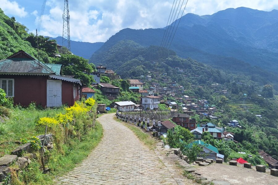
Jakhama
1.2 km from Dzukou Valley centre
Jakhama is a Southern Angami Naga village located 18 km south of Kohima, the capital of Nagaland. It hosts the St. Joseph's College, Jakhama.
Don’t just visit. Understand before you go.
No active alerts. Carry layers, keep emergency contacts handy and check local conditions before you set out.
Mountain weather changes quickly. Treat this as a planning signal, not a final safety clearance - confirm locally before you set out.
A rolling green valley on the Nagaland-Manipur border behind Japfu Peak - famous for its seasonal carpet of wildflowers (the Dzukou lily) and a gentle trek-in from Viswema or Zakhama.
DIY is the main way - this is the upgrade
Prefer a custom version of this trip? We can help you turn this DIY plan into a private, flexible experience for your dates, pace, comfort and group size.
Tap “Get directions” to open any spot straight in Google Maps.
1.2 km from Dzukou Valley centre
Jakhama is a Southern Angami Naga village located 18 km south of Kohima, the capital of Nagaland. It hosts the St. Joseph's College, Jakhama.
1.4 km from Dzukou Valley centre
Teyozwü Hill is a picturesque hill located in the western part of Viswema in the Indian state of Nagaland.
2.7 km from Dzukou Valley centre
Swe–ba is ward under Viswema, Nagaland located along the Asian Highway 1 and also the NH2.
2.8 km from Dzukou Valley centre
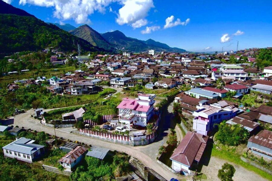
Viswema is a Southern Angami Naga village in the Kohima District of the Indian state of Nagaland. With a resident population of 7417, it is the second biggest village in the state and is part of the contiguous built-u…
3.8 km from Dzukou Valley centre
Kigwema is a village in the southern region of Nagaland, India. It is located in Jakhama Circle of Kohima District. The village is located 15 km (9.3 mi) south of Kohima, the capital of Nagaland.
4 km from Dzukou Valley centre
The Kezol-tsa Forest is a thick old-growth forest along the southern and northern edges of the Indian states of Nagaland and Manipur. The forest is located on the southern part of Dzüko Valley.
4.4 km from Dzukou Valley centre
Khuzama is a Southern Angami Naga village on the inter-state border with Manipur located 28 km south of Kohima, the capital of Nagaland.
4.8 km from Dzukou Valley centre
Mima is an Angami Naga village in the Kohima District of the Indian state of Nagaland.
4.9 km from Dzukou Valley centre
Kisama Heritage Village is a Heritage Village located on the slopes of a hill between Kigwema and Phesama Villages in the Kohima District of the Indian state of Nagaland. The Heritage Village is the venue of the annua…
5.8 km from Dzukou Valley centre
The Dzüko Valley is a valley located in the Naga Hills along the border of the Northeast Indian states of Manipur and Nagaland. This valley is well known for its natural environment, seasonal flowers and flora & fauna.
5.9 km from Dzukou Valley centre
Mount Tempü is a peak of the Barail Range rising at the mountainous border of the Indian states of Manipur and Nagaland. With a height of 2994 m above sea level, is the highest peak of Manipur and the second highest p…
6.1 km from Dzukou Valley centre
Mount Japfü is a mountain peak of the Barail Range, located in Kohima District of Nagaland in India, about 15 kilometres (9 mi) south of Kohima, the capital of Nagaland.
Stay
Camp Dziikopii & Homestay, NH2, Kigwema Town - 797005, Nagaland, India
Stay
Hillfoot Camp & Homestay, NH2, Kigwema Town - 797005, Nagaland, India
Stay
Hotel Simorb, Paramedical-Jail Rd, Porter Lane, Kohima - 797001, Nagaland, India
Stay
The Heritage, Raj Bhavan Circular Rd, Midland Colony, Kohima - 797001, Nagaland, India
Food
Heaven’s Dew Cafeteria, NH2, Kigwema Town - 797005, Nagaland, India
Food
The Naga touch, Hortiscape Approach Road, Phesama - 479001, Nagaland, India
Food
Hortiscape Approach Road, Phesama - 479001, Nagaland, India
Travellers
As a woman travelling solo, the safety notes gave me real confidence.
Bought the Spiti map - opened straight in Google Maps, navigated offline. Brilliant.
The free hotel and attraction search saved me hours of research.
Finally, India travel info I can actually trust. The confidence scores are genius.
The day-wise plan made my first solo trip to Manali completely stress-free.