Sandakphu Trek

Know the trail before you step on it - difficulty, permits, weather, guide need and route clarity in one place.

Moderate Autumn
Explore Summit & Peak

Trek safety, weather & access status

Generally safe to travel Open to trek Mar–Dec

Advisory

Acclimatise properly, carry warm layers even in summer, check weather and route status, and trek with a registered guide on high-altitude routes.

Live weather

8°C Rain
  • Feels 7°C
  • 3 km/h wind
  • 100% humidity

Mountain weather changes quickly. Treat this as a planning signal, not a final safety clearance - confirm locally before you set out.

Difficulty Moderate
Max altitude 3,636 m
Distance 45 km
Duration 5–6 days
Best time March to May, October to December
Fitness Moderate - long ridge days
Start point Sepi / Maneybhanjang
End point Sandakphu
No permit needed

DIY Trek Readiness: can you go self-planned?

Beginners Some experience helps
Guide Optional / self-guided
Permit Not needed
Fitness Moderate - long ridge days
Trail clarity Clear
Network on trail None
Max altitude 3,636 m
Best season Mar to May, Oct to Dec
Languages Bengali, Hindi, English
How is this score calculated?

This is a DIY-readiness gauge - how do-able it is to plan and travel yourself. Destinations show it as a 0-5 DIY Score; treks & routes as a 0-10 Score (a wider scale for the extra variables they carry). Both are built from these factors:

  • SafetyLocal safety, terrain and current advisory conditions along the route.
  • Transport accessHow easily you can reach the place and move around without your own vehicle.
  • NetworkMobile signal and data coverage you can expect on the way.
  • Season reliabilityHow dependable the weather and season window is for travel.
  • Budget clarityHow predictable day-to-day costs are, with few surprises.
  • Trail / route clarityHow well-marked and easy to follow the route or trail is.
  • Stay availabilityThe choice and reliability of places to stay along the way.
  • First-timer friendlinessHow forgiving it is for a first-time independent traveller.
  • Solo / women comfortHow comfortable and safe it is for solo and women travellers.
  • Local supportAvailability of guides, hosts and on-the-ground help if you need it.
Read the full method →

Readiness verdict

  • Best forFit beginners to intermediate trekkers
  • Not ideal forAnyone not up for long walking days or sudden weather
  • Go DIY only ifYou can manage long walking days, low or no network, basic navigation and changing mountain weather.
Guide: Optional Permit: Not needed Network: None on trail
Plan it yourself

The DIY deep-dive

Sandakphu Trek is at its best in March to May, October to December. It covers about 45 km, runs over 5–6 days, tops out near 3,636 m.

DIY route options

The classic route Start from Sepi / Maneybhanjang and follow the standard 4-day line - the most reliable, well-trodden way to do it.
Self-guided or with a guide Do it solo with the offline Gaia GPS trail file, or hire a local guide at Sepi / Maneybhanjang for the navigation and logistics.

What most travellers miss

  • Download offline maps and share your plan first - the mobile network here is patchy to none.
  • Do not rush past Sandakphu - most people treat it as a quick stop, but it is worth a slower evening.
  • Time it for March to May, October to December. Outside that window, snow, weather or road closures can cut access.

Where to base yourself

Tumling Trailhead base - last shops, network and gear before you set off.
Sandakphu A key stop on the route - where the trek halts for the night.
Gurdum A key stop on the route - where the trek halts for the night.

DIY is the main way - this is the upgrade

Need expert help planning this trek?

Prefer not to manage permits, guide coordination, stays and route pacing yourself? We can help you turn this trek into a private, supported experience for your dates, group size and comfort level.

  • Permit and guide coordination
  • Private group support
  • Route pacing and halt planning
  • Stay, meals and local logistics
Enquire for pricing Enquire on WhatsApp

About this trek

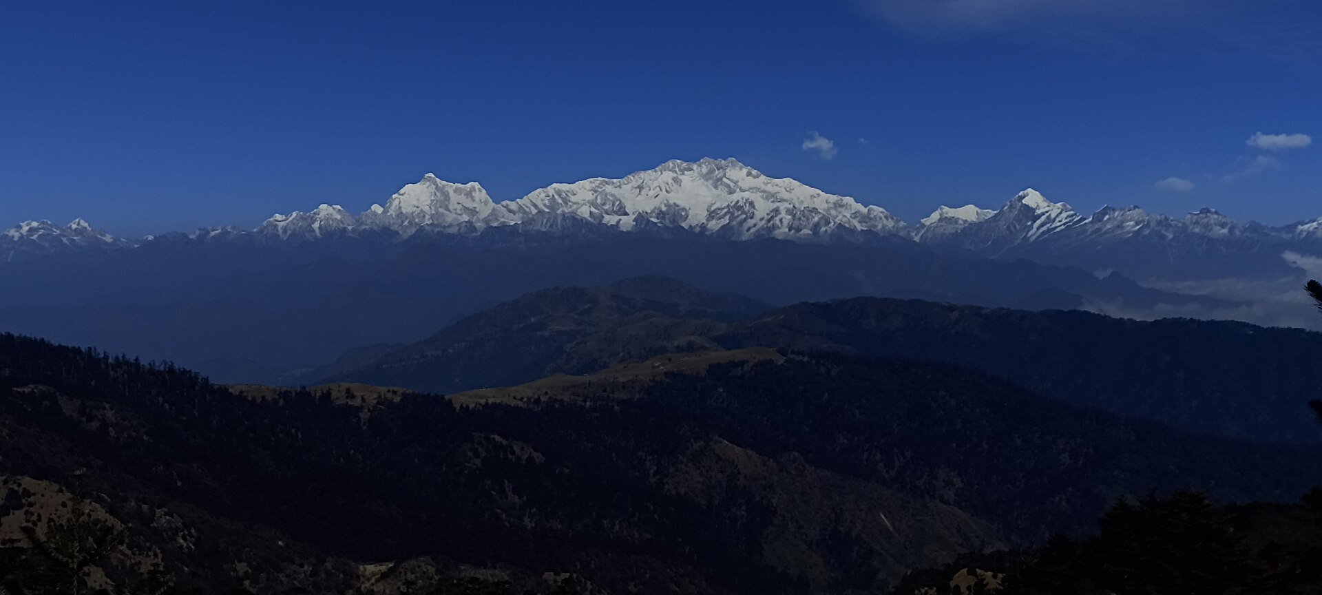
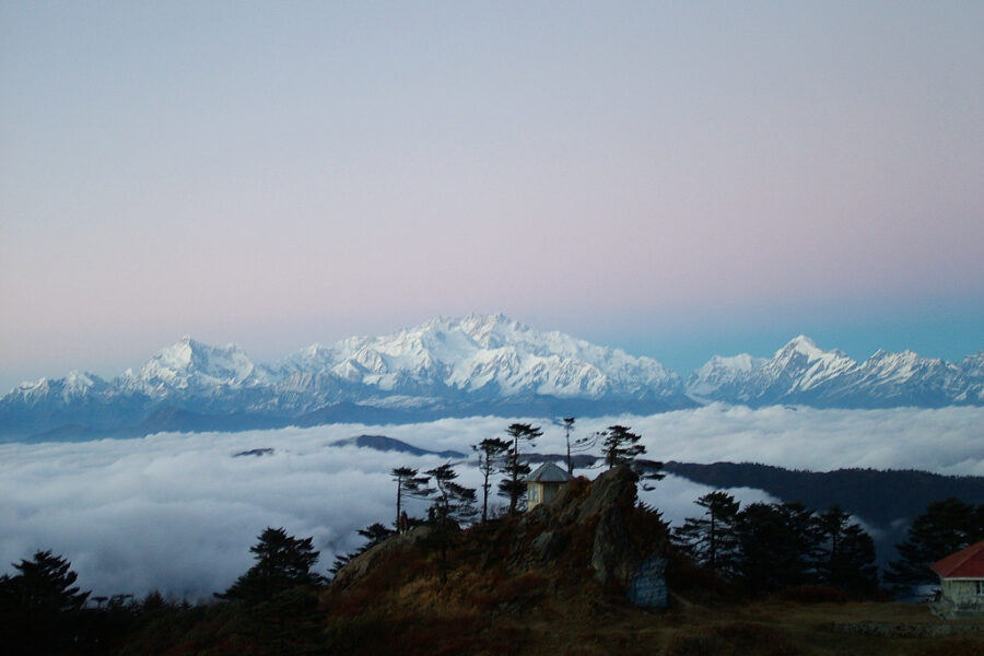
Sandakphu, at about 3,636 m, is the highest point in West Bengal and the star of the Singalila ridge trek along the India–Nepal border. From the top you can see four of the world’s five highest peaks – the “Sleeping Buddha” of Kanchenjunga, plus Everest, Lhotse and Makalu on the horizon.

The trail winds through the Singalila National Park, rhododendron forest and ridge-top villages, glorious in the spring bloom and the clear skies of autumn.

Essential packing list

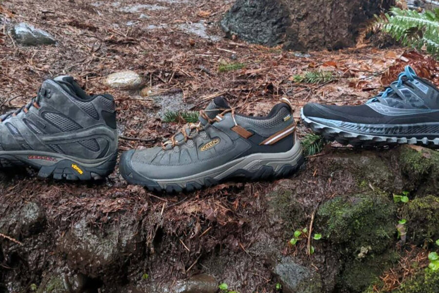
  • Trekking shoes with grip
  • Warm base layer + fleece
  • Down jacket / warm jacket
  • Rain shell / poncho
  • Headlamp + extra batteries
  • Water bottle / hydration bladder
  • Sunglasses, cap, sunscreen
  • Personal medicines
  • Power bank
  • Offline maps
  • Cash and ID copies
  • Permit documents, if applicable

Map

Nearby route landmarks & places to know

Tap “Get directions” to open any spot straight in Google Maps.

Sandakphu

0.2 km from Sepi / Maneybhanjang, West Bengal centre

Sandakphu or Sandakpur at 3,636 m (11,929 ft) is a mountain peak in the Singalila Ridge on the border between India and Nepal. It is the highest point of the ridge and of the state of West Bengal, India. The peak is l…

Maimajhuwa

4.8 km from Sepi / Maneybhanjang, West Bengal centre

Maimajhuwa is a town and Village Development Committee in Ilam District in the Province No. 1 of eastern Nepal. At the time of the 1991 Nepal census it had a population of 3,543 persons living in 578 individual househ…

Mabu, Nepal

5.8 km from Sepi / Maneybhanjang, West Bengal centre

Mabu is a village and Village Development Committee in Ilam District in the Province No. 1 of eastern Nepal. At the time of the 1991 Nepal census it had a population of 2,908 persons living in 539 individual households.

Singalila National Park

6.7 km from Sepi / Maneybhanjang, West Bengal centre

Singalila National Park is a national park of India located on the Singalila Ridge at an elevation of more than 2,300 metres above sea level, in the Darjeeling district of West Bengal. It is well known for the trekkin…

Kala Pokhri

7.2 km from Sepi / Maneybhanjang, West Bengal centre

Kalipokhri is a small Himalayan village inside the Singalila National Park in the Darjeeling subdivision, Darjeeling district in the state of West Bengal, India. It lies on the trekking route from Mane Bhanjang to San…

Prangbung

7.4 km from Sepi / Maneybhanjang, West Bengal centre

Prangbung is a village development committee in Panchthar District in the Province No. 1 of eastern Nepal. At the time of the 1991 Nepal census it had a population of 4585.

Kanyam

8.6 km from Sepi / Maneybhanjang, West Bengal centre

Kanyam is a town and a tourist destination located in Ilam District of Nepal. It comes under Suryodaya Municipality in Ilam District in Koshi Province of eastern Nepal.

Todke waterfall

8.8 km from Sepi / Maneybhanjang, West Bengal centre

Todke waterfall is located in the hills of Maimajhuwa near Mai Pokhari in Ilam district. The fall feeds the Mai River. It has a height of 85 m.

Sidin

8.9 km from Sepi / Maneybhanjang, West Bengal centre

Sidin is a village development committee in Panchthar District in the Mechi Zone of eastern Nepal. At the time of the 1991 Nepal census, a population of 3901 people was living in 694 individual households.

Jamuna, Nepal

9.9 km from Sepi / Maneybhanjang, West Bengal centre

Jamuna is a town and Village Development Committee in Ilam District in the Province No. 1 of eastern Nepal. At the time of the 1991 Nepal census it had a population of 3,277 persons living in 567 individual households.

Stay & food planning around the trailhead

Base and stock up at the trailhead before you start; on the trail expect basic halts and simple meals - tea stops and packed snacks, with no cafe-style reliability once you set off.

Stay

Sunrise Restaurant

Sunrise Restaurant, 02DR017, Falelung, Panchthar, Nepal

Open in Maps

Stay

Sherpa Chalet

Sherpa Chalet, 02DR017, Falelung, Panchthar, Nepal

Open in Maps

Stay

Ningma Homestay

Ningma Homestay, 02DR017, -, West Bengal, India

Open in Maps

Stay

Pandim lodge

Pandim lodge, NH74, Lumchok, Ilam District, Nepal

Open in Maps

Stay

K.B Hotel

K.B Hotel, NH74, Lumchok, Ilam District, Nepal

Open in Maps

Stay

Karma Tenzi Hotel

Karma Tenzi Hotel, NH74, Lumchok, Ilam District, Nepal

Open in Maps

Frequently asked questions about Sandakphu Trek

What is the best time to do the Sandakphu Trek?

The best time for the Sandakphu Trek is March to May, October to December.

How difficult is the Sandakphu Trek?

The Sandakphu Trek tops out near 3,636 m.

How long is the Sandakphu Trek?

It covers about 45 km and takes around 5–6 days.

Comments are closed.