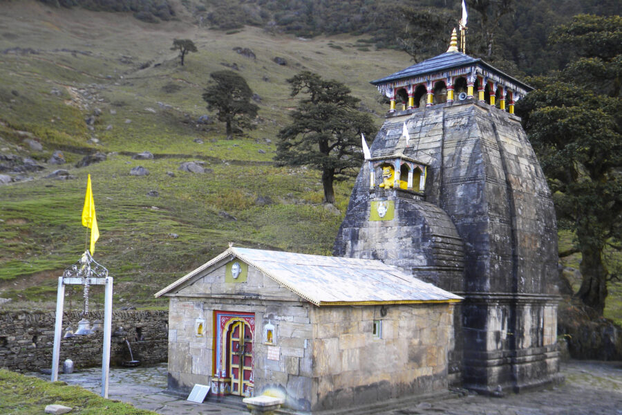
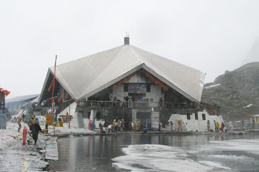
Kedarnath

Know the trail before you step on it - difficulty, permits, weather, guide need and route clarity in one place.

Trek safety, weather & access status

Generally safe to travel Off-season - likely closed Nov–Apr

Advisory

No active alerts. Carry layers, keep emergency contacts handy and check local conditions before you set out.

Live weather

11°C Overcast
  • Feels 9°C
  • 2 km/h wind
  • 51% humidity

Mountain weather changes quickly. Treat this as a planning signal, not a final safety clearance - confirm locally before you set out.

Max altitude 3,583 m
Distance 16 km one way
Duration 2 days
Best time May to June, September to October
Fitness Moderate - a long uphill walk; ponies and palki available
Start point Gaurikund
End point Gaurikund
No permit needed

DIY Trek Readiness: can you go self-planned?

Beginners Some experience helps
Guide Optional / self-guided
Permit Not needed
Fitness Moderate - a long uphill walk; ponies and palki available
Trail clarity Clear
Network on trail Patchy
Max altitude 3,583 m
Best season Nov–Apr
Languages Hindi, Garhwali

Readiness verdict

  • Best forFit beginners to intermediate trekkers
  • Not ideal forAnyone not up for long walking days or sudden weather
  • Go DIY only ifYou can manage long walking days, basic navigation and changing mountain weather.
Guide: Optional Permit: Not needed Network: Patchy
Plan it yourself

The DIY deep-dive

DIY route options

The classic route Start from Gaurikund and follow the standard 2-day line - the most reliable, well-trodden way to do it.
Time it by season Plan around May to June, September to October for the best weather, views and open access.

What most travellers miss

  • Download offline maps and share your plan first - the mobile network here is patchy to none.
  • Do not rush past Guptkashi - most people treat it as a quick stop, but it is worth a slower evening.
  • Time it for May to June, September to October. Outside that window, snow, weather or road closures can cut access.

Where to base yourself

Kedarnath Trailhead base - last shops, network and gear before you set off.
Guptkashi A key stop on the route - where the trek halts for the night.

DIY is the main way - this is the upgrade

Need expert help planning this trek?

Prefer not to manage permits, guide coordination, stays and route pacing yourself? We can help you turn this trek into a private, supported experience for your dates, group size and comfort level.

  • Permit and guide coordination
  • Private group support
  • Route pacing and halt planning
  • Stay, meals and local logistics
Enquire for pricing Enquire on WhatsApp

About this trek

Kedarnath is the highest of the Panch Kedar and a Char Dham temple, set under the Kedarnath peak at 3,583m. The stone temple is reached by a 16km trek (or pony/palki) from Gaurikund. Open roughly May to October.

Essential packing list

  • Trekking shoes with grip
  • Warm base layers and fleece
  • Down jacket
  • Rain shell / poncho
  • Headlamp with extra batteries
  • Water bottle or hydration bladder
  • Sunglasses, cap and sunscreen
  • Personal medicines
  • Power bank
  • Offline maps
  • Cash and ID copies
  • Permit documents

Map

Nearby route landmarks & places to know

Tap “Get directions” to open any spot straight in Google Maps.

Kedarnath

0.5 km from Gaurikund, Uttarakhand centre

Kedarnath is a town and Nagar Panchayat in the Rudraprayag district of Uttarakhand, India, known primarily for the Kedarnath Temple. It is approximately 86.5 kilometres from Rudraprayag, the district headquarters. Ked…

Chorabari Lake

1.6 km from Gaurikund, Uttarakhand centre

Chorabari Lake, also known as Gandhi Sarovar, was a glacial lake at the snout of the Chorabari Glacier at an altitude of 3,900 m (12,800 ft). It was about 2 km (1.2 mi) upstream from the town of Kedarnath in the India…

Sumeru Parbat

6.8 km from Gaurikund, Uttarakhand centre

Sumeru Parbat is a 6,350-metre (20,830 ft) high mountain in the Gangotri Glacier region of Garhwal Himalaya, Uttarakhand, India. The mountain is encircled by Kedarnath and Kedardome in the north, Kharchakund in the we…

Kedarnath (mountain)

6.8 km from Gaurikund, Uttarakhand centre

Kedarnath and Kedarnath Dome are two mountains in the Gangotri Group of peaks in the western Garhwal Himalaya in Uttarakhand state, India. Kedarnath (Main) lies on the main ridge that lies south of the Gangotri Glacie…

Kedarnath Glacier

7.4 km from Gaurikund, Uttarakhand centre

Kedarnath Glacier is located in Garhwal Himalaya mountain ranges, in the state of Uttarakhand, India.

Kharchakund

7.9 km from Gaurikund, Uttarakhand centre

Kharchakund is a mountain of the Garhwal Himalaya in Uttarakhand, India. The elevation of Kharchakund is 6,612 metres (21,693 ft) and its prominence is 835 metres (2,740 ft). It is 64th highest located entirely within…

Stay & food planning around the trailhead

Base and stock up at the trailhead before you start; on the trail expect basic halts and simple meals - tea stops and packed snacks, with no cafe-style reliability once you set off.

Stay

Indore House

Indore House, Kedarnath Temple Road, Kedarnath -, Uttarakhand, India

Open in Maps

Stay

Punjab & Sindh Niwas

Punjab & Sindh Niwas, Kedarnath Temple Road, Kedarnath -, Uttarakhand, India

Open in Maps

Stay

New Himachal House

New Himachal House, Kedarnath Temple Road, Kedarnath -, Uttarakhand, India

Open in Maps

Stay

SSS Residency

SSS Residency, Kedarnath Temple Road, Kedarnath -, Uttarakhand, India

Open in Maps

Comments are closed.

More treks nearby

View all

Travel guides related to Kedarnath

View all