Jabalpur Cantonment
0.5 km from Sankri, Uttarakhand centre
Jabalpur Army Station is an Army station town in Jabalpur District in the Indian state of Madhya Pradesh.
Know the trail before you step on it - difficulty, permits, weather, guide need and route clarity in one place.
No active alerts. Carry layers, keep emergency contacts handy and check local conditions before you set out.
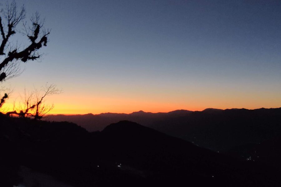
Mountain weather changes quickly. Treat this as a planning signal, not a final safety clearance - confirm locally before you set out.
DIY is the main way - this is the upgrade
Prefer not to manage permits, guide coordination, stays and route pacing yourself? We can help you turn this trek into a private, supported experience for your dates, group size and comfort level.
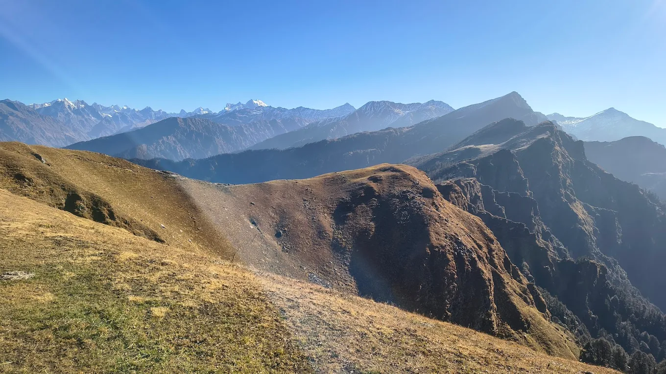
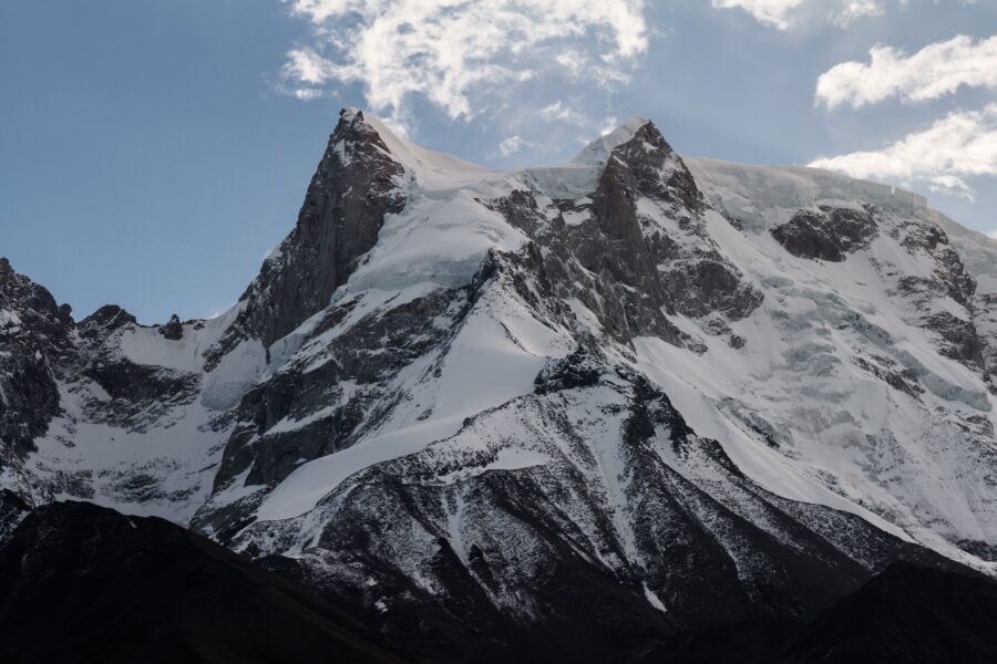
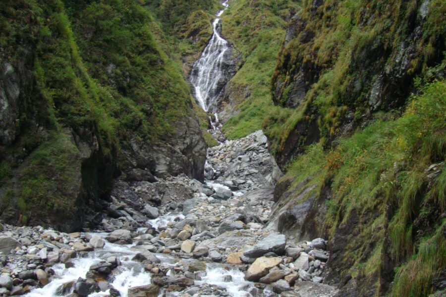
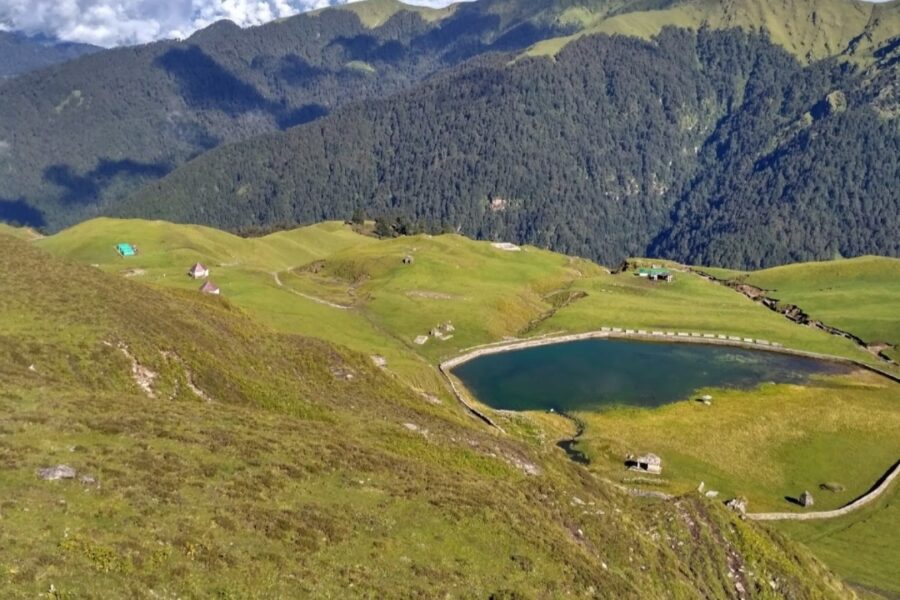
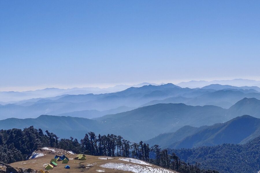
Phulara Ridge is unusual – instead of climbing to a single high point, you walk along an open ridge with valleys falling away on both sides. From Sankri in the Govind sanctuary, it threads oak and rhododendron forest to a long, grassy crest with views toward the Swargarohini and Bandarpoonch peaks.
Tap “Get directions” to open any spot straight in Google Maps.
0.5 km from Sankri, Uttarakhand centre
Jabalpur Army Station is an Army station town in Jabalpur District in the Indian state of Madhya Pradesh.
1.9 km from Sankri, Uttarakhand centre
The Roman Catholic Diocese of Jabalpur is a diocese located in the city of Jabalpur in the ecclesiastical province of Bhopal in India.
2.2 km from Sankri, Uttarakhand centre
Paat Baba Mandir is a Hanuman temple located in Jabalpur, Madhya Pradesh, India. It was built by a British officer on 12 August 1903. It is believed that Lord Hanuman helped in building the Gun Carriage Factory, and h…
2.2 km from Sankri, Uttarakhand centre
Garrison Ground is a multi purpose stadium in Jabalpur, Madhya Pradesh. The ground is mainly used for organizing matches of football, cricket and other sports. The stadium has hosted three first-class matches in 1953 …
2.4 km from Sankri, Uttarakhand centre
Jabalpur railway division is one of the three railway divisions under West Central Railway zone (WCR) of Indian Railways. This railway division was formed on 1 April 1952 and its headquarters are located at Jabalpur c…
3 km from Sankri, Uttarakhand centre
Gun Carriage Factory Jabalpur, also known as GCF Jabalpur is a defence factory and a census town in Jabalpur district in the state of Madhya Pradesh, India. Located in the scenic surroundings of the Satpura Range, thi…
3.5 km from Sankri, Uttarakhand centre
Jabalpur Division is an administrative geographical unit of Madhya Pradesh state of India. Jabalpur is the administrative headquarters of the division. As of 2023, the division consists of districts of Balaghat, Chhin…
4 km from Sankri, Uttarakhand centre
The Jubbulpore Division, named after its capital Jabalpur (Jubbulpore), was one of the four former administrative divisions of the Central Provinces of British India. It was located in the Mahakoshal region of present…
4 km from Sankri, Uttarakhand centre
Mahakoshal or Mahakaushal is a region of central India. Mahakoshal lies in the upper or eastern reaches of the Narmada River valley in the Indian state of Madhya Pradesh. Jabalpur is the largest city in the region. Ni…
4 km from Sankri, Uttarakhand centre
Rani Durgawati Museum is a museum in Jabalpur city in Madhya Pradesh state of India. It was established in 1976. It houses a fine collection of sculptures, inscriptions and prehistoric relics. The museum is dedicated …
4.1 km from Sankri, Uttarakhand centre
Hitkarini Sabha is a historic, educational, non-profit organization located in the city of Jabalpur, Madhya Pradesh, India. It is runs some of the oldest academic institutions in the region. It was founded in 1868 by …
4.2 km from Sankri, Uttarakhand centre
Jabalpur, formerly anglicised as Jubbulpore, is a city situated on the banks of the Narmada River in the state of Madhya Pradesh, India. Jabalpur is the administrative headquarters of the Jabalpur district and the Jab…
Base and stock up at the trailhead before you start; on the trail expect basic halts and simple meals - tea stops and packed snacks, with no cafe-style reliability once you set off.
Stay
Hilton Garden Inn Jabalpur, 466, Hitkarini Engineering College Road, Cantonment, - 482005, Madhya Pradesh, India
Stay
Vijan Mahal Hotel, Shri S.C. Sinha Lane, Cantonment, - 482020, Madhya Pradesh, India
Stay
Satya Ashoka, Wright Town, Jabalpur, Jabalpur - 482001, Madhya Pradesh, India
Stay
Hotel Shree Hari (correct location), Jabalpur Flyover, Vijay Nagar, Jabalpur - 482001, Madhya Pradesh, India
Stay
Visitor Guest House, Airport Road, Cantonment, - 482005, Madhya Pradesh, India
Stay
hotel yuvraj, Zero Degree Road, Vijay Nagar, Jabalpur - 482003, Madhya Pradesh, India
Food
Gopal JI, Delite Talkies Road, Sadar, Jabalpur - 482007, Madhya Pradesh, India
Food
Indian Coffee House, Dr Barat Road, Sadar, Jabalpur - 482001, Madhya Pradesh, India
Food
Hotel Bigwig, 1450, Dr Barat Road, Jabalpur, Jabalpur - 482001, Madhya Pradesh, India
Food
Indian Coffee House, Shri S.C. Sinha Lane, Cantonment, - 482020, Madhya Pradesh, India
Food
Mama Maggi Point, Airport Road, Cantonment, - 482005, Madhya Pradesh, India
Food
hot chillli, Jabalpur Flyover, Jabalpur, Jabalpur - 482004, Madhya Pradesh, India
Food
Central Mess, mess entrance, Cantonment, - 482005, Madhya Pradesh, India
Trek guides 8 min read
Are you searching for a Top five range of thrilling, stimulating, and daring winter treks? Uttarakhand is your…
Trek guides 14 min read
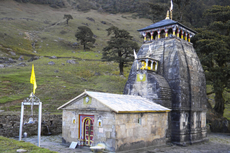
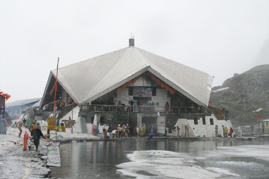
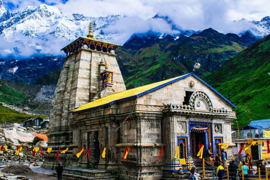
Kedarnath Yatra is a pilgrimage to the holy shrine of Lord Shiva located in the Garhwal Himalayas in…
Trek guides 12 min read
Are you looking for a day by day detailed daily itinerary for a trip to Chopta, Tungnath and…
Trek guides 9 min read
One of the very few Himalayan Treks which goes to an alpine lake. Best winter trek in Uttarakhand…

Packing guides 12 min read
When planning a vacation, the first two places that typically come to mind are Mountains or beaches. After…
Packing guides 9 min read
If you are wondering how to best prepare for a trek in the Himalayas when your local environment…

Packing guides 12 min read
While trekking shoes and running shoes may seem similar but, trekking shoes and running shoes are two different…

Packing guides 9 min read
"Explore India's Great Outdoors with the Best Trekking Backpacks" Are you looking for the perfect backpack for your…
Travellers
As a woman travelling solo, the safety notes gave me real confidence.
Bought the Spiti map - opened straight in Google Maps, navigated offline. Brilliant.
The free hotel and attraction search saved me hours of research.
Finally, India travel info I can actually trust. The confidence scores are genius.
The day-wise plan made my first solo trip to Manali completely stress-free.