Gulmarg

Don’t just visit. Understand before you go.

Kashmir

Safety & current conditions in Gulmarg

Generally safe to travel

Advisory

No active alerts. Carry layers, keep emergency contacts handy and check local conditions before you set out.

Live weather

13°C Thunderstorm
  • Feels 14°C
  • 3 km/h wind
  • 94% humidity

Mountain weather changes quickly. Treat this as a planning signal, not a final safety clearance - confirm locally before you set out.

Overview

The "meadow of flowers" - a Kashmir resort of one of the world's highest gondolas (Apharwat), the highest golf course in the world, and India's premier ski slopes.

DIY Snapshot

DIY difficulty Easy
Best for Nature, Slow travel
Ideal days 2 days
Best season Mar to Jun (meadows), Dec to Feb (snow)
Budget β‚Ή8,000-β‚Ή15,000
Local transport Moderate
Internet Good
Safety comfort High
Languages Kashmiri, Urdu, Hindi
Plan it yourself

The DIY deep-dive

DIY route options

The classic route Base around Gulmarg and run the standard 2-day plan - the easiest, most dependable version of the trip.
Snow season or clear season Best months are March to June (meadows), December to February (snow). Go in the colder months for snow, or post-monsoon for clear skies and green trails.

What most travellers miss

  • Time it for March to June (meadows), December to February (snow). Outside that window, snow, weather or road closures can cut access.
  • Carry enough cash - card and UPI are unreliable once you leave the main town.

Where to base yourself

Gulmarg The main base - most stays, food and transport, and the easiest to reach.

DIY is the main way - this is the upgrade

Want expert help adapting this plan?

Prefer a custom version of this trip? We can help you turn this DIY plan into a private, flexible experience for your dates, pace, comfort and group size.

  • Custom route planning
  • Stay and area recommendations
  • Private group support
  • Local expert guidance
Enquire for pricing Enquire on WhatsApp

Map

Curated places to visit in Gulmarg

Tap β€œGet directions” to open any spot straight in Google Maps.

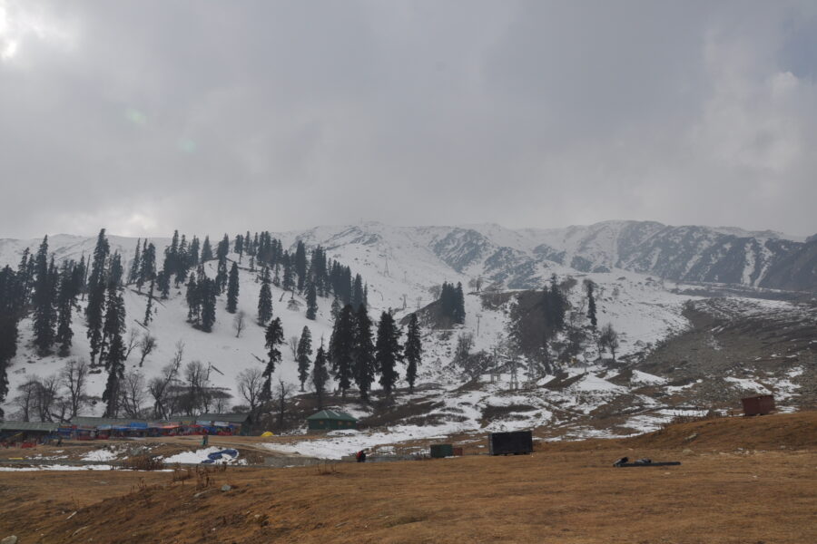
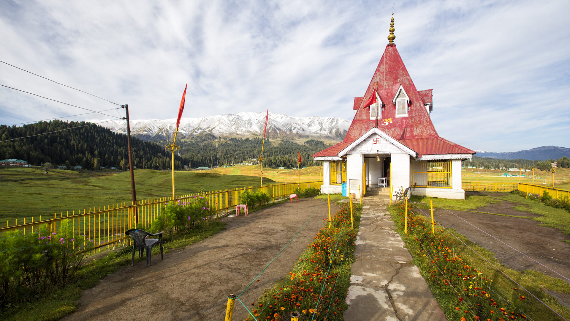
St Mary's Church, Gulmarg

0.6 km from Gulmarg centre

St Mary's Church is located in the Valley of Shepherds in Gulmarg and is one of the oldest churches in Jammu and Kashmir, India. It was built in 1902, during the period of British rule, and was constructed in a Britis…

Khilanmarg

0.7 km from Gulmarg centre

Khilanmarg is a small valley in Jammu and Kashmir, India, located about 6 kilometres (3.7Β mi) away from the Gulmarg. The meadow, carpeted with flowers in the spring, is the site for Gulmarg's winter ski runs and offer…

Gulmarg Golf Club

0.7 km from Gulmarg centre

The Gulmarg Golf Club is a public golf course in a meadow at Gulmarg in Baramulla district, Jammu and Kashmir, India. It lies 35 km from Baramulla city. The golf course, at an elevation of 2,650 metres (8,690Β ft) abov…

Gulmarg Gondola

0.8 km from Gulmarg centre

Gulmarg Gondola in Gulmarg, Jammu and Kashmir, is the second longest and second highest cable car in the world. Higher lines include the Mi TelefΓ©rico in Bolivia and at Jade Dragon Snow Mountain.

Hardu-Aboora

1.2 km from Gulmarg centre

Hardu-Aboora or Hardu-Aboor is a locality in Karhama tehsil in Baramulla district in the Indian union territory of Jammu and Kashmir. It is situated on the banks of Ferozpora Nallah, at the foothills of the mountain r…

Baba Reshi

3.2 km from Gulmarg centre

Baba Reshi is a settlement in Baramulla district of the Indian union territory of Jammu and Kashmir. It is named after the Sufi saint Baba Reshi. It is located about 13Β km (8.1Β mi) from Gulmarg near the Alpather Lake.

Ferozpora

3.2 km from Gulmarg centre

Ferojpora, also known as Ferojpura, Ferojpur, Ferozpora or Ferozpur, is a village in the Baramulla district of Jammu and Kashmir, India. It is situated on the bank of Nalla Ferozpora and is 1 kilometre (0.62Β mi) from …

Tangmarg

3.2 km from Gulmarg centre

Tangmarg is a town and tehsil in Baramulla district in Indian union territory of Jammu and Kashmir. In 2014, Tangmarg was granted a sub division and trifurcated into three Tehsils, with Sub Divisional Magistrate SDM O…

Gulmarg Wildlife Sanctuary

4.3 km from Gulmarg centre

The Gulmarg Wildlife Sanctuary spread over 180 square kilometres (69Β mi2) is a protected area in Gulmarg, Baramulla district of Jammu and Kashmir, India. It is one of the most beautiful and attractive sanctuaries in J…

Kulhama

7.3 km from Gulmarg centre

Kulhama or Kulhoam is a village situated in Tangmarg tehsil of Baramulla district in the Indian union territory of Jammu and Kashmir. The village is located 42 kilometres from the district headquarters Baramulla and 7…

Apharwat Peak

8.2 km from Gulmarg centre

Apharwat Peak is a summit, situated at a height of 4,390 metres (14,403Β ft) above the sea level, in Gulmarg, India. It receives heavy snowfall and remains covered with snow for much of the year. The Line of Control (L…

Gulistan, Baramulla

9.5 km from Gulmarg centre

Gulistan is a village located in the region of North Kashmir with administrative headquarters in Baramulla district in the Indian union territory of Jammu and Kashmir and its sub-district units are pinpointed in Baram…

Hotels & food in Gulmarg

Stay

Yemberzal

Yemberzal, Gulmarg Road, Gulmarg - 193403, Jammu and Kashmir, India

Open in Maps

Stay

Global

Global, Gulmarg-Tangmarg road, Gulmarg - 193403, Jammu and Kashmir, India

Open in Maps

Stay

Green Hights

Green Hights, Gulmarg Road, Gulmarg - 193403, Jammu and Kashmir, India

Open in Maps

Stay

Hill Top

Hill Top, Gulmarg Road, Gulmarg - 193403, Jammu and Kashmir, India

Open in Maps

Stay

Pine View Resort

Pine View Resort, Up Road, Gulmarg - 193403, Jammu and Kashmir, India

Open in Maps

Stay

Kingsley

Kingsley, Up Road, Gulmarg - 193403, Jammu and Kashmir, India

Open in Maps

Stay

Pine spring

Pine spring, to Pinepalace Way, Gulmarg - 193403, Jammu and Kashmir, India

Open in Maps

Comments are closed.

Treks nearby

View all

Travel guides related to Gulmarg

View all

Related destinations

View all