Kanamo Peak Trek

Know the trail before you step on it - difficulty, permits, weather, guide need and route clarity in one place.

Trek safety, weather & access status

Generally safe to travel Open to trek Jun–Sep

Advisory

No active alerts. Carry layers, keep emergency contacts handy and check local conditions before you set out.

Live weather

2°C Snow
  • Feels -1°C
  • 5 km/h wind
  • 68% humidity

Mountain weather changes quickly. Treat this as a planning signal, not a final safety clearance - confirm locally before you set out.

Max altitude 5,974 m
Distance 20 km
Duration 5 days
Best time June to September
Fitness Very high - a near-6,000m walk-up; full acclimatisation needed
Start point Kibber
End point Kibber
No permit needed

DIY Trek Readiness: can you go self-planned?

Beginners Some experience helps
Guide Recommended
Permit Not needed
Fitness Very high - a near-6,000m walk-up; full acclimatisation needed
Trail clarity Faint
Network on trail None
Max altitude 5,974 m
Best season Jun–Sep
Languages Spitian (Bhoti), Hindi

Readiness verdict

  • Best forExperienced, fit trekkers comfortable at altitude
  • Not ideal forFirst-time trekkers going without any support
  • Go DIY only ifYou can manage long walking days, low or no network, basic navigation and changing mountain weather.
Guide: Recommended Permit: Not needed Network: None on trail
Plan it yourself

The DIY deep-dive

DIY route options

The classic route Start from Kibber and follow the standard 5-day line - the most reliable, well-trodden way to do it.
Self-guided or with a guide Do it solo with the offline Gaia GPS trail file, or hire a local guide at Kibber for the navigation and logistics.

What most travellers miss

  • Download offline maps and share your plan first - the mobile network here is patchy to none.
  • Do not rush past Kanamo Base Camp - most people treat it as a quick stop, but it is worth a slower evening.
  • Time it for June to September. Outside that window, snow, weather or road closures can cut access.
  • Use the acclimatisation day in full - fast itineraries are what catch people out at altitude here.

Where to base yourself

Kibber Trailhead base - last shops, network and gear before you set off.
Kanamo Base Camp A key stop on the route - where the trek halts for the night.
Kaza A key stop on the route - where the trek halts for the night.

DIY is the main way - this is the upgrade

Need expert help planning this trek?

Prefer not to manage permits, guide coordination, stays and route pacing yourself? We can help you turn this trek into a private, supported experience for your dates, group size and comfort level.

  • Permit and guide coordination
  • Private group support
  • Route pacing and halt planning
  • Stay, meals and local logistics
Enquire for pricing Enquire on WhatsApp

About this trek

Kanamo is one of the highest trekking peaks you can summit without ropes or technical climbing – a steep, lung-busting walk-up from Kibber in the Spiti cold desert to 5,974m. Full acclimatisation in Kaza and Kibber is essential before the summit push.

Essential packing list

  • Trekking shoes
  • Warm layers
  • Rain shell
  • Headlamp
  • Water bottle
  • Trekking shoes with grip
  • Warm base layers and fleece
  • Down jacket
  • Rain shell / poncho
  • Headlamp with extra batteries
  • Water bottle or hydration bladder
  • Sunglasses, cap and sunscreen
  • Personal medicines
  • Power bank
  • Offline maps
  • Cash and ID copies
  • Permit documents

Map

Nearby route landmarks & places to know

Tap β€œGet directions” to open any spot straight in Google Maps.

Kibber

6.3 km from Kibber, Himachal Pradesh centre

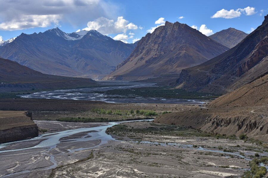
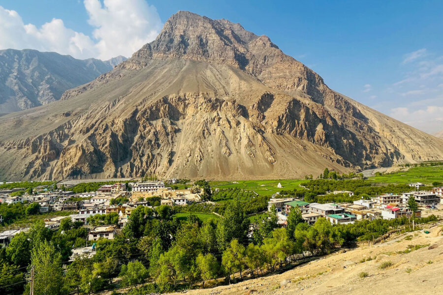
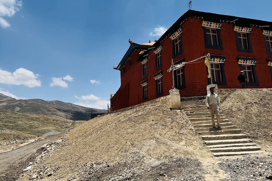
Kibber, also Kibber Khas and Khyipur, is a village high in the Spiti Valley in the Himalayas at 4,270Β m (14,010Β ft) in Himachal Pradesh in northern India. It contains a monastery and is a base for visiting the Kibber …

Key Monastery

8.5 km from Kibber, Himachal Pradesh centre

Kye Gompa is a Tibetan Buddhist monastery of the Gelugpa sect located on top of a hill at an altitude of 4,166 metres (13,668Β ft) above sea level, close to the Spiti River, in the Spiti Valley of Himachal Pradesh, Lah…

Chau Chau Kang Nilda

9.2 km from Kibber, Himachal Pradesh centre

Chau Chau Kang Nilda also known as 'Guan Nelda' or 'blue moon in the sky' is a mountain in the western Himalayas. It lies in the northern Indian state of Himachal Pradesh.

Langza

9.3 km from Kibber, Himachal Pradesh centre

Langza is a small village located in Spiti Tehsil of Lahaul and Spiti district, Himachal Pradesh. It is set at the base of Chau Chau Kang Nilda mountain, also known as the Princess Mountain.

Stay & food planning around the trailhead

Base and stock up at the trailhead before you start; on the trail expect basic halts and simple meals - tea stops and packed snacks, with no cafe-style reliability once you set off.

Stay

Deshek Homestay

Deshek Homestay, Kaza-Kibber Road, Kibber -, Himachal Pradesh, India

Open in Maps

Stay

Norling Guesthouse

Norling Guesthouse, Kaza-Kibber Road, Kibber -, Himachal Pradesh, India

Open in Maps

Stay

Kaza-Kibber Road

Kaza-Kibber Road, Kibber -, Himachal Pradesh, India

Open in Maps

Stay

Thinley's Home Stay

Thinley's Home Stay, Kaza-Kibber Road, Kibber -, Himachal Pradesh, India

Open in Maps

Stay

Norling

Norling home stay Kibber, Kaza-Kibber Road, Kibber -, Himachal Pradesh, India

Open in Maps

Stay

Tashi Zom

Tashi Zom, Kaza-Kibber Road, Kibber -, Himachal Pradesh, India

Open in Maps

Stay

Guest House

Guest House, Kibber-Tashigang Road, Kibber - 172114, Himachal Pradesh, India

Open in Maps

Comments are closed.

More treks nearby

View all

Travel guides related to Kanamo Peak Trek

View all