Generally safe to travel
Roads likely closed Jun–Oct
Seasonal access right now.
Chandratal is usually reachable only Jun–Oct. Outside these months the roads are often closed by snow and the area can be cut off. Confirm current road status before you travel.
Advisory
No active alerts. Carry layers, keep emergency contacts handy and check local conditions before you set out.
Live weather
-12°CClear sky
Feels -16°C
1 km/h wind
49% humidity
Mountain weather changes quickly. Treat this as a planning signal, not a final safety clearance - confirm locally before you set out.
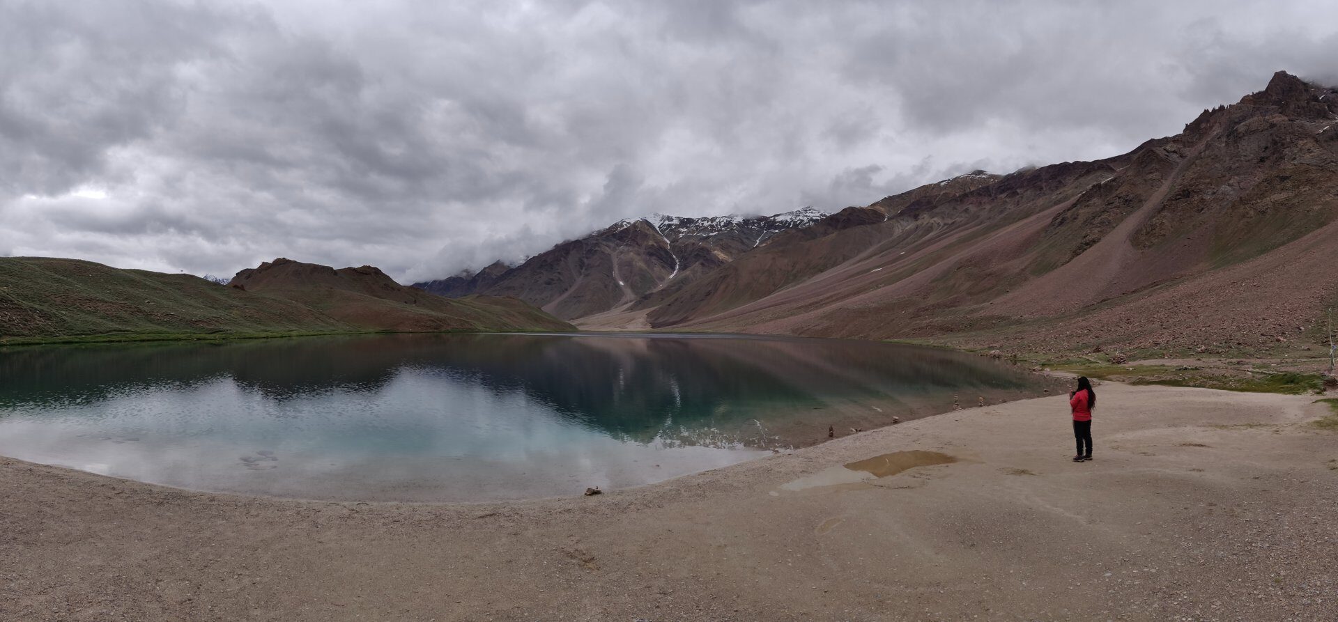
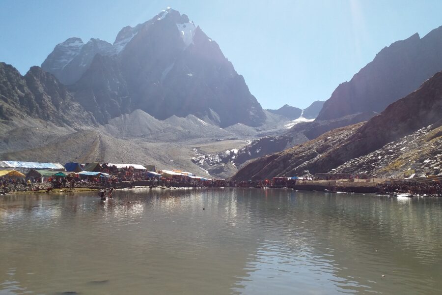
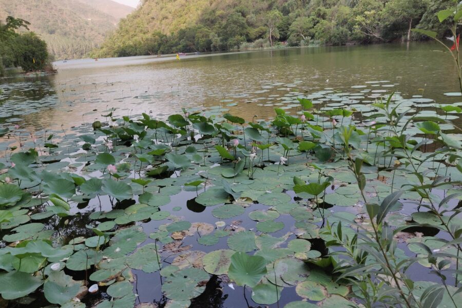
Chandra Taal, the "moon lake", is a crescent-shaped lake at about 4,300 m on the Samudra Tapu plateau in the upper Chandra valley of Lahaul, close to the source of the Chandra river. It lies inside the Chandratal Wildlife Sanctuary and is a protected wetland, so there is no camping on the shore: the tented camps are a couple of kilometres back along the approach road, and the last kilometre to the water is on foot. The lake is reached by a 12 km dirt road that leaves the Manali-Kaza highway near Batal, and most people pair it with Kunzum Pass on the way into or out of Spiti.
DIY Snapshot
DIY difficultyHigh
Best forNature, Road trip, Trek
Ideal days1-2 days
Best seasonMid-Jun to early Oct, when the Batal road and the camps are open
Budget₹5,000-₹9,000
Local transportHard
InternetPoor
Safety comfortHigh
LanguagesHindi, Lahauli
How is this score calculated?
This is a DIY-readiness gauge - how do-able it is to plan and travel yourself. Destinations show it as a 0-5 DIY Score; treks & routes as a 0-10 Score (a wider scale for the extra variables they carry). Both are built from these factors:
SafetyLocal safety, terrain and current advisory conditions along the route.
Transport accessHow easily you can reach the place and move around without your own vehicle.
NetworkMobile signal and data coverage you can expect on the way.
Season reliabilityHow dependable the weather and season window is for travel.
Budget clarityHow predictable day-to-day costs are, with few surprises.
Trail / route clarityHow well-marked and easy to follow the route or trail is.
Stay availabilityThe choice and reliability of places to stay along the way.
First-timer friendlinessHow forgiving it is for a first-time independent traveller.
Solo / women comfortHow comfortable and safe it is for solo and women travellers.
Local supportAvailability of guides, hosts and on-the-ground help if you need it.
The sweet spot for visiting Chandratal is Mid-June to early October, when the Batal road and the camps are open. Give it 1-2 days to do it justice. Budget roughly ₹5,000-₹9,000 per person for a DIY trip. It is a good fit if you are after nature, road trips and trekking. It is a sensible pick for solo women travellers.
DIY route options
From Manali, on into SpitiManali to the Chandratal camps for one night, the lake at first light, then over Kunzum Pass to Losar and Kaza. The usual way to start a Spiti loop from the Manali side.
At the end of a Spiti tripCome up from Kaza through Losar and over Kunzum already acclimatised, spend a night at the camps, then drive down to Manali. Much easier on the body than coming straight up from Manali.
Half-day visit from Losar or BatalSkip the camps: sleep at Losar (about 38 km away) or in the basic rooms at Batal and see the lake as a half-day trip. Warmer at night, but you miss the lake in the early light.
What most travellers miss
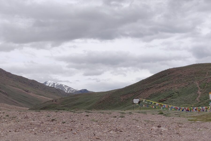
The walk from the parking to the water is only about 1 km, but at 4,300 m it feels much longer - go slowly.
The path round the lake shore is the best part of the visit; give it an unhurried couple of hours.
Mornings are usually calmer and clearer; in the afternoon the wind picks up and cloud builds over the ridges.
Most people drive in and out in one go from Manali; a night at the camps, or coming from the Spiti side, makes the altitude far easier.
Where to base yourself
Chandratal campsNight 1
LosarNight 2
DIY is the main way - this is the upgrade
Want expert help adapting this plan?
Want a version of this plan built around you? We rework the route, pacing, stays and budget for your dates and group size - you travel independently, with the research already done.
Nearest airportBhuntar (Kullu) is the nearest airport, about 160 km and most of a day away via Manali and the Atal Tunnel. Chandigarh, about 380 km, has far more flights and is the usual start for a road trip.
Nearest railway stationThere is no railway anywhere near. Chandigarh and Kiratpur Sahib are the closest useful broad-gauge stations, a full day's drive away with a night in Manali.
Bus & road hubIn season, HRTC's early-morning Manali-Kaza bus passes the Chandratal turn near Batal, but nothing runs up the last 12 km to the lake. Most people come by shared or private taxi from Manali.
Taxis & local transportShared taxis and private hires from Manali cover Chandratal through the season; agree beforehand whether the fare includes the side road to the lake parking and any waiting time. There are no app cabs.
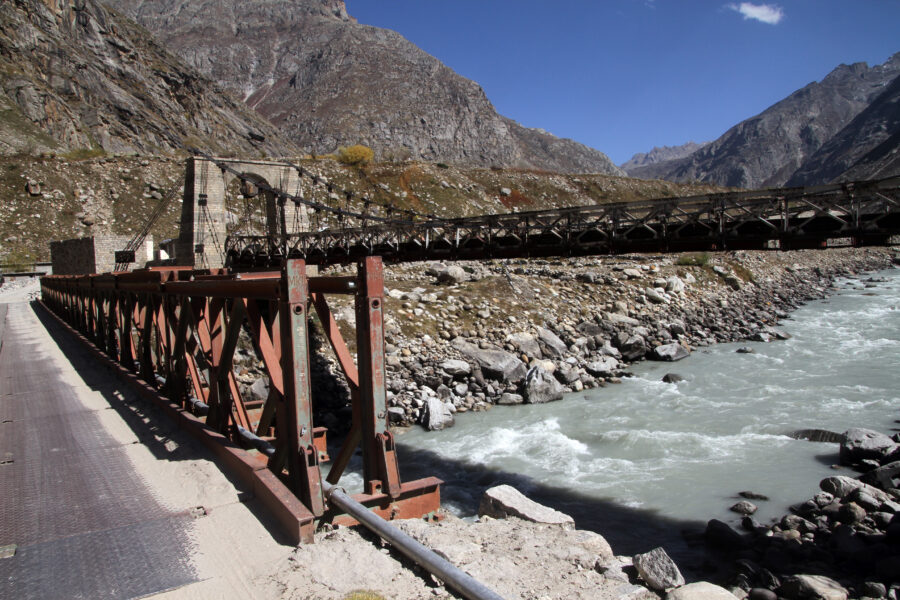
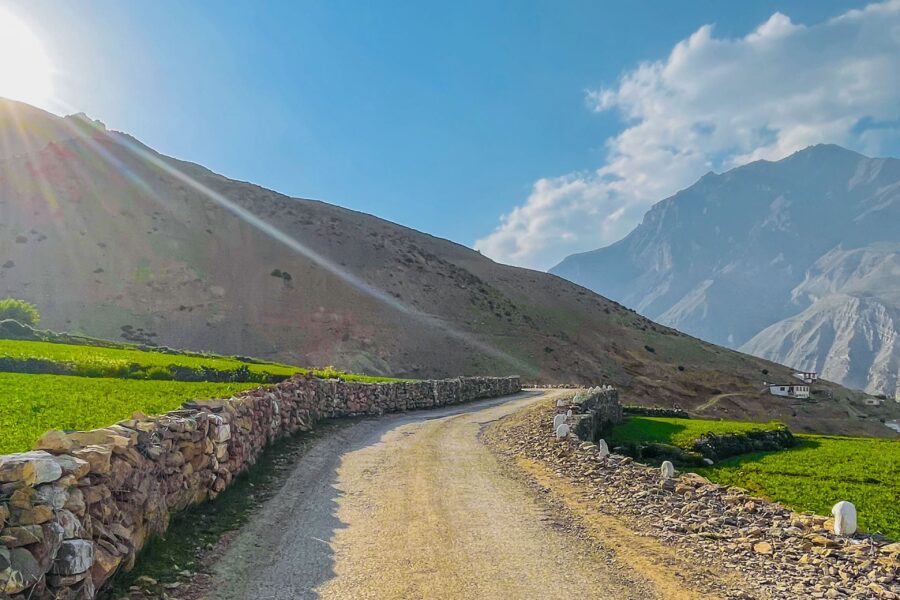
Road access & best routeAbout 110 km from Manali: through the Atal Tunnel to Gramphu, then the rough, mostly unpaved road up the Chandra valley via Chhatru to Batal. The Chandratal road branches off about 3 km past Batal (8 km below Kunzum Pass) and runs 12 km to a parking area about 1 km from the lake. Check /is-it-open/chandratal/ and /is-it-open/atal-tunnel/ on this site before setting off. Fill up in Manali - there is no fuel until Kaza.
Things to do & travel tips
Check /is-it-open/chandratal/ (and /is-it-open/kunzum/ if you are crossing into Spiti) on this site before you go; the road usually opens in June and the camps shut by early October.
The lake is at about 4,300 m. Coming straight up from Manali in one day is a big jump; arriving from the Spiti side, already acclimatised, is easier. If a headache or nausea gets worse, go down.
Camping and littering at the shore are not allowed; stay at the registered camps back along the road and carry all your rubbish out.
There is no mobile signal at Chandratal or Batal; tell someone your plan and download offline maps in Manali.
Nights are below freezing even in July and August - bring a down jacket, a warm cap and gloves.
Map
Curated places to visit in Chandratal
Tap “Get directions” to open any spot straight in Google Maps.
Chandra Taal
0 km from Chandratal centre
Chandra Taal is a lake in the upper Chandra valley of the Lahul and Spiti district of Himachal Pradesh, India. Chandra Taal is near the source of the Chandra River. Despite the rugged and inhospitable surroundings, it…
Kunzum Pass, is a high mountain pass in the eastern Kunzum Range of the Himalayas. It connects Lahaul valley and Spiti valley. It is on the route from Gramphoo in Lahaul to Kaza the subdivisional headquarters of Spiti…
Usual season: June to September. Usually reachable from June to September or early October.
-12°C now, partly cloudy · next 3 days -20° to 0°
Usual seasons are approximate; snow and landslides can close any road. Check locally before you set off.
Frequently asked questions about Chandratal
What is the best time to visit Chandratal?
The best time to visit Chandratal is Mid-June to early October, when the Batal road and the camps are open.
How many days do you need for Chandratal?
Plan for about 1-2 days to see Chandratal at an easy pace.
What is the nearest railway station to Chandratal?
The nearest railway station to Chandratal is There is no railway anywhere near. Chandigarh and Kiratpur Sahib are the closest useful broad-gauge stations, a full day's drive away with a night in Manali.
What is the nearest airport to Chandratal?
The nearest airport to Chandratal is Bhuntar (Kullu) is the nearest airport, about 160 km and most of a day away via Manali and the Atal Tunnel. Chandigarh, about 380 km, has far more flights and is the usual start for a road trip.
How do you reach Chandratal by road?
About 110 km from Manali: through the Atal Tunnel to Gramphu, then the rough, mostly unpaved road up the Chandra valley via Chhatru to Batal. The Chandratal road branches off about 3 km past Batal (8 km below Kunzum Pass) and runs 12 km to a parking area about 1 km from the lake. Check /is-it-open/chandratal/ and /is-it-open/atal-tunnel/ on this site before setting off. Fill up in Manali - there is no fuel until Kaza.
How much does a trip to Chandratal cost?
A DIY trip to Chandratal starts around ₹5,000-₹9,000 per person, depending on stays, travel and season.
Is Chandratal good for first-time or solo travellers?
Yes - Chandratal is a sensible pick for solo women travellers, if you plan the basics ahead.